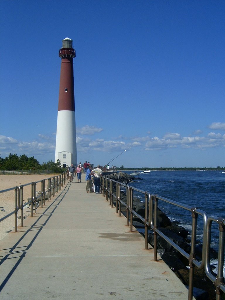
our island: August 2006

Wednesday, August 30, 2006

...from the Beach


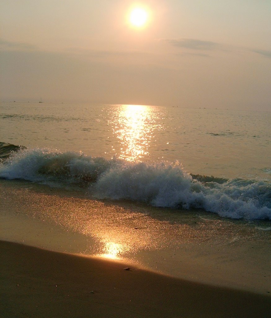
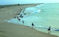
The last three days have been dreary and gray. Not exactly picture taking weather. But as I sit here and listen to news of Ernesto in Florida - of and of the even stronger John, bearing down on Acapulco - and of a Pacific typhoon (name unpronouncable) which threatens to wipe Wake Island off the map - I felt that one additional tribute to our gorgeous dunes was in order.

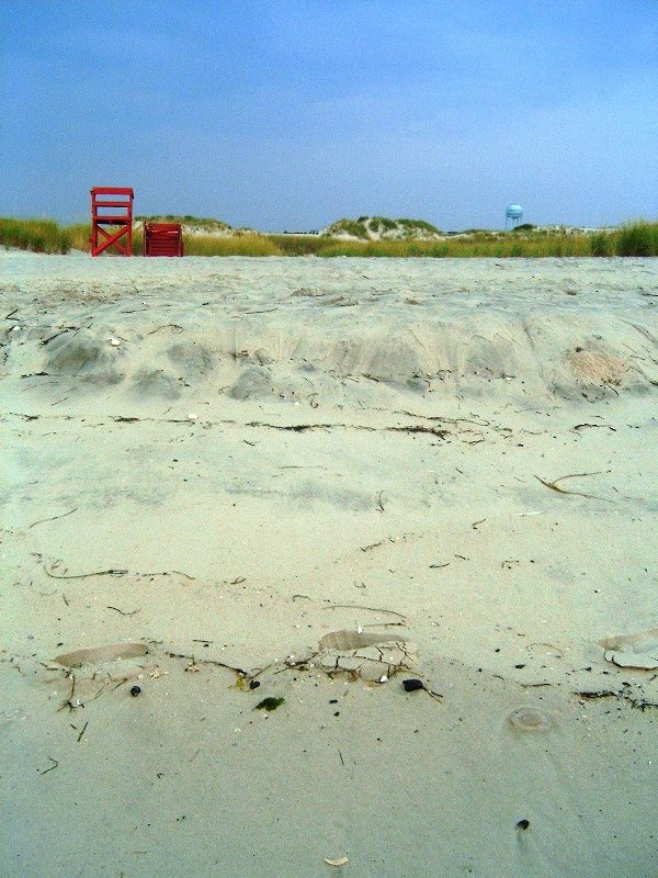
As you head back towards 12th Street from the water's edge it's all uphill. Just getting from the water to the life guard's chair requires climbing up over the ledge at the water line and then slogging through dry powdery sand which threatens to stay your feet at each step.

Then its back over the lower dune area, with its grasses, crossroads in the sand and litter and recyclin
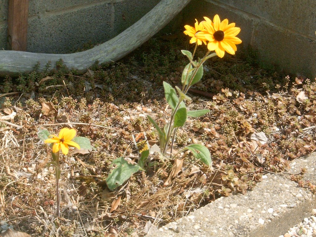
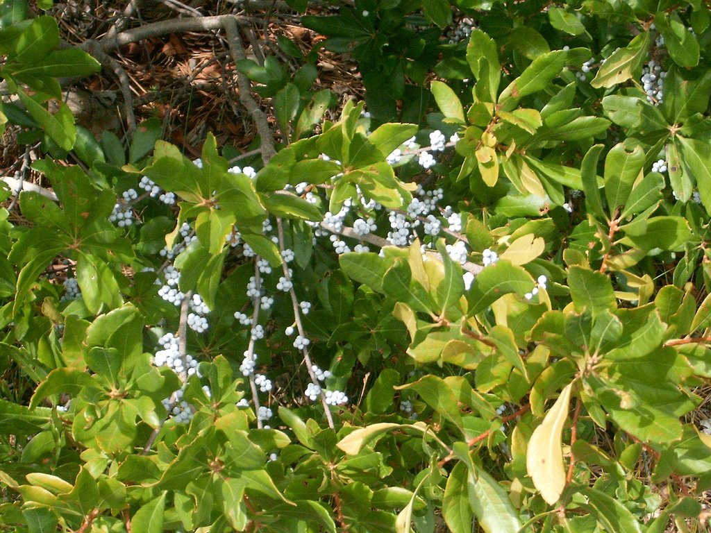
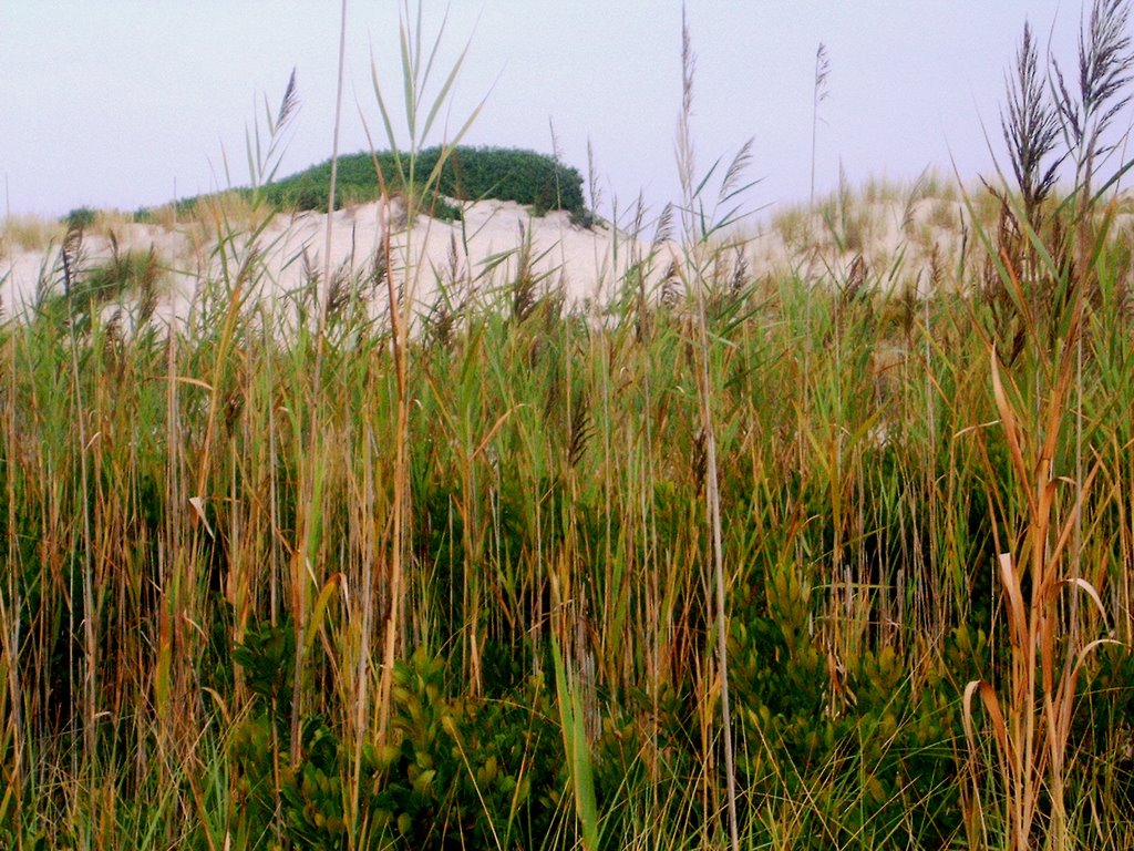
g barrels stategically sprinkled throughout. I can't resist the chance to present one more natural beach grass masterpiece.

And onward to the end of the first boardwalk, up that last big dune, which seems much higher than when you came to the beach earlier- making you so glad you resisted the urge to carry non-essentials with you . Then, after you finally reach those benches which look so far up in the sky, you still have to go down the other side of the dune and walk through the denser vegetation on the street-side boardwalk - and a block and a half back to the house. It's a long trek, and discourages everyday beach going - but at times like this as we hear storm news on all sides we are s-o-o-o grateful for our beautiful dune area.

P.S. Rafito is in Miami as I write so you soon may get some more professional looking views of the Island once he arrives.

Saturday, August 26, 2006

At Water's Edge


It was a somewhat hazy morning at first. The sky had a pinkish tinge - not quite red enough to warrant that we "take warning". There's not much I can say that would add to the images. It's a beautiful hour for a walk along the water's edge.

Our sands are not covered with tropical shells, but this morning the beach glistened with a myriad of small jellyfish, whole or in pieces, shining pink and white in the early morning sun.

A more usual sight along our sands is the horseshoe crab - they have preceded us by centuries and will still be inhabiting the shores here for centuries to come.

As the sun rose higher the breakfast line formed at surf's edge and the day began in earnest. I headed back toward's the house and my own breakfast.


Friday, August 25, 2006

...a World Between...


The dune area between our houses and the ocean is lovingly preserved. We all know that another big storm will visit us someday - hurricane or nor'easter - and the dunes are our first and only line of defense. For many years there have been campaigns to gather used Christmas trees (natural, of course) to bury in the sand. Dune grasses and other indigenous plants have been reintroduced. The fortunate result of much work and investment is the unique dune area - a world between the streets and the ocean. Many plants, such as this Queen Anne's Lace have come to make their home here, and the beginnings of a restored maritime forest area can be enjoyed.

The natural vegetation is a much better protection for the dunes - and for the homes behind them - than the old snow fences, now abandoned, which ran along between the grass on practically bare sand dunes when I was here as a child in an attempt to keep us off the dunes. I can remember climbing and rolling down the dunes on nighttime treks along the beach, tremendous fun, but not very ecologically sound, and no longer permitted.


Sunrise over the dunes.

To the Beach...

In New Jersey, when you head towards the ocean you're going "down the shore". Only once you've reached the shore do you actually go to the beach. On 12th Street the walk to the beach is quite a hike - one which I personally only attempt early in the morning. Once the sun is high and the sand is burning it's quite an undertaking.
The dunes and beach have built up considerably since the construction of the new jetty by the lighthouse. When I was a child the waves were much closer to the road (and that's not just a senior perception). A conscious effort has been made to build up and protect the dune area. Boardwalks have been added to make it possible to reach the water. Just follow the path, making sure you stay out of the bushes and away from any red leaves in groups of three.
The boardwalk does end before you reach the highest point of the dune. Memorial benches have been donated for the relief of all those toting beachchairs, blankets, unbrellas, pails, children, etc. towards a relaxing day at the beach.
After reaching the top of the dune and catching your breath you'll see that you still have a way to go - but the end is in sight, and if you keep your eye on the lifeguard chairs you're sure to reach the water's edge eventually and be able to cool your toes in the Atlantic.

Thursday, August 24, 2006

Shore Signs

Maybe it's because there are so many seasonal visitors here, but we seem to communicate an extraordinary amount of information here through signs. It also may just be my perception after coming from Venezuela. It seems to me that people here expect, and prefer, to have all the rules spelled out where they can find them for themselves. Then they don't have to spend any time looking for someone to ask how things work. They read the signs, and for the most part act according to the information given.
In Maracaibo, no matter how many signs are posted no one believes them until they've found somone to ask. Then, even if they get the same information in person, they'd really prefer to check with someone else before deciding if they need to adapt their own behavior in any way.
We also have seasonal and off season rules here, as in any vacation town, so you have to be aware of the dates and changes as they roll around. Speed limits vary with the season as do rules for dogs on the beach, the need for beach badges and the use of public tennis courts, etc.
All in all, for a community which grows so much in the summer, and fills up with so many people who have never been here before and don't know how things work, our signs seem to do a rather good job of keeping us all on the same page.

Wednesday, August 23, 2006

Mosaic

The original mission of this blog was to provide an idea of the particular vegetation and "look" of our island. Today I'm reverting to that goal with a few impressions. As always this blog presents "my" island and doesn't aspire to anything more.
This spunky little Black-eyed Susan is right at the corner of our driveway and front walk. Despite much neglect and the dumping of beach bags and chairs atop her, she keeps coming back all on her own. I love seeing her there.

Bayberries - universally famous in candle form - and the namesake of the Bayberry Inn, one of my mother's favorite restaurants on the island. They grow wild and are also cultivated in local gardens.

Beach plums - prolific all over the island and delicious when made into Beach Plum Jam or, so I've been told, into Beach Plum Wine. I must admit I've never tasted the wine, but I can vouch for the jam.

And I always come back to my favorite - the bay grass. I love the view of the shallows with the grasses as they change in color and texture with the seasons.

Just a few more pieces of the mosaic that is "my" island.

Tuesday, August 22, 2006

A Little Museum History


The Barnegat Light Museum now occupies what was once the Elementary School. From 1903 through June, 1951, classes were held here for local elementary students. Small as it is there was a girl's entrance on the left and a boy's entrance on the right.
The museum was inaugurated in 1954. It's most asked about exhibit is certainly the original first-order Fresnel lens from the lighthouse. The beehive-shaped lens is six feet in diameter, 12 feet high and formed from 1,024 separate prisms mounted in bronze fittings. Our favorite model was pleased to pose before something that makes him look a bit smaller by comparison.
The museum is maintained by the Barnegat Light Historical Society, whose volunteers are always on duty to provide extra local details and answer any questions posed by visitors. On the grounds behind the museum the Garden Club of Long Beach Island maintains the Edith Duff Gwinn Garden, providing a lovely, quiet spot planted with native shrubs and flowers. A real treat for anyone interested in local plantings.

Monday, August 21, 2006

Kubel's

No trip north on Bayview would be complete without a stop at the large blue building on the corner of 7th Ave., Kubel's. A mixture of a traditional fishermen's bar, a popular summer restaurant and a year round center of local life, Kubel's has been a central point in our Barnegat Light experience for the past four years. Summer nights, popcorn shrimp, lunch with Santa (who arrives by fire engine), my mother's 85th birthday party, and many other memories will always remain.
The popular "new room", under the striped awnings in this view from Bayview, offers diners a view of the bay, and those spectacular sunsets.
The porch booths, under the awnings to the right in the front view, once smoking territory, have now joined the general dining environment since New Jersey became a non-smoking state this year. And out front is the rock where generations of children have climbed and had their pictures taken as their parties waited to be seated.
And of course there is the bar, also now smokless, where Randy feels at home ordering his Coors Light, they serve an excellent Pinot Grigio, and everybody knows your name. But the best part of Kubel's will always be the people, owners, staff, regulars and visitors; without them its just a blue building by the bay.

Sunday, August 20, 2006

North on Bayview

What we intended to do yesterday, before becoming involved in the reclamming, was to take you for a stroll down Bayview, from 12th St. to where it ends at 6th.

Here you see our model next to the municipal ramp at 10th, where we left him yesterday. The reclamming activity was just behind the ramp office shack.


From 10th St. up to 7th you find docking facilities for small boats and several businesses which rent out boats and supply necessities for day fishermen. We highly recommend Kelly’s. Ask for Angie, and get to see some of her artwork while you’re there.

Just past Kelly’s is the Coast Guard Station. Our model is now posed in front of a view of the Coast Guard docks where a variety of sea craft are harbored. The Coast Guard is kept busy saving small craft boaters from themselves, and from the inlet breakers.

Bayview ends at 6th Street where there is a marina for larger boats. You can charter a party boat here, or arrange for parasailing over the bay. The ever-present lighthouse can be seen to the north, but you can’t really get there from here, at least not directly. You have to go one block east and then north to the Light. If you like you can cut across the lot of the old coffee shack to save a few steps.

Randy Helps Reclam

On Saturday Randy and I set out north from 12th Street along Bayview to take pictures for future posts. It was a beautiful summer day, so there was considerable congestion around the municipal ramp on 10th Street.
As we maneuvered around the crowd jockeying to get their small craft into the bay I noticed some unusual activity behind the ramp office.
A few questions revealed that the group was working as part of a project to reclam Barnegat Bay. Tiny, pinhead-sized, clams had been placed in mesh bottomed buckets at the beginning of the season. Each Saturday they are taken out and “counted” by volume. So far it seems they have grown twelve fold. Each bucket received ½ liter originally and the reports yesterday were all over 6 liters each. The tiny clams are taken out of each bucket, measured by cupfuls and then replaced in their “nursery”. Randy was thrilled to help with the replacing part.
The clams will spend the winter in mesh bags in the bay with the hope that they will be thumb nail size by next season. That about does it for my knowledge of clam seeding – you can find out more at http://www.reclamthebay.org/ .
We will try to go back next Saturday to help again, as Randy’s name was to be added to the work list, so he now has responsibilities.

Friday, August 18, 2006

The Maritime Forest


The Maritime Forest trail is a 1/5 mile circuit through one of the last remnants of native maritime forest in the state. Informative plaques identifying the vegetation and explaining the ecology of the maritime forest are scattered along the trail. One of the first signs identifies Poison Ivy - one of our heartiest plants - not only along the trail, but all over the island. It is highly recommended that anyone who is even slightly allergic stick to the open pathways. The forest, also home to black cherries and Eastern red cedars among others, is an important resting and feeding area for birds on their long migratory flights to and from their nesting areas.

The rugosa rose is common in and out of the trail area. The bright orange fuits - rose hips - are a fabulous source of Vitamin C.

Thursday, August 17, 2006

The Jetty


My favorite part of the park is the jetty. It is 3/4 of a mile long in its entirety, 1033 ft. of that length are paved and enclosed by railings. On stormy days the waves break up over the rocks and railings, and if conditions are really wild access to the jetty is closed off. Under normal conditions, however, the jetty is open to fishermen and strollers. It starts out from the lighthouse, then turns a sharp right corner along the southern side of the inlet.

A parallel jetty runs along the northern shore of the inlet from Island Beach State Park.

Where the paved walkway ends, the rock jetty continues. Fishermen and explorers continue to venture out over the rocks, and the gulls enjoy the sun and scenery.

Wednesday, August 16, 2006

Old Barney


You can't really say you've been to Barnegat Light until you visit the lighthouse which gave us our name. The inlet was baptized "Barendegat" by early dutch explorers - Inlet of breakers - due to the large waves which hinder its navegation. The first lighthouse on the inlet entered into service in 1835, but the sand around it soon eroded and a new light - still standing - was commisioned in 1856 and first lit in 1859. Lt George Meade, of Civil War reknown, supervised the construction. (He appears next to our group of climbers in the Girl's Weekend post.) The new lighthouse stood 165 feet tall and had a first order Fresnel lens, which now resides in the Barnegat Light Museum.

During World War II the lighthouse was used as a lookout tower by the Coast Guard. It was retired from service in 1944, and officially dedicated as a State Park in 1957. The park includes fishing areas, bird nesting preserves, a native maritime forest area with a trail, the Lighthouse, the jetty, and the Interactive Center, where I volunteer occasionally. This year four video cameras were installed at the top of the lighthouse so that those who can't make the climb can enjoy a real-time view from the Interactive Center. And just in case you're wondering - there are 217 steps up the lighthouse, and it's the second tallest light in NJ. (Two of my most FAQs.)

If you look at the first picture above you can see the Maritime Forest area left of the Lighthouse. The large sandy area in the foreground is a bird nesting area which protects certain endangered birds and welcomes migratory invasions. This expanse of sand came into being after the construction of the jetty by the Army Corps of Engineers in 1992. Before that, the water came right up to the dunes, and to the Lighthouse, which was in danger of toppling into the inlet. The houses in this photo (taken from the jetty) were once literally waterfront property. Of course, in those days you could swim on the beach in the park - now its just fishing, bird watching and enjoying the scenery, but is still visited by hundreds of people every day during the season. The beach area is the site of bonfires - to enjoy the full moon during July and August, and a special Holloween event in October.